

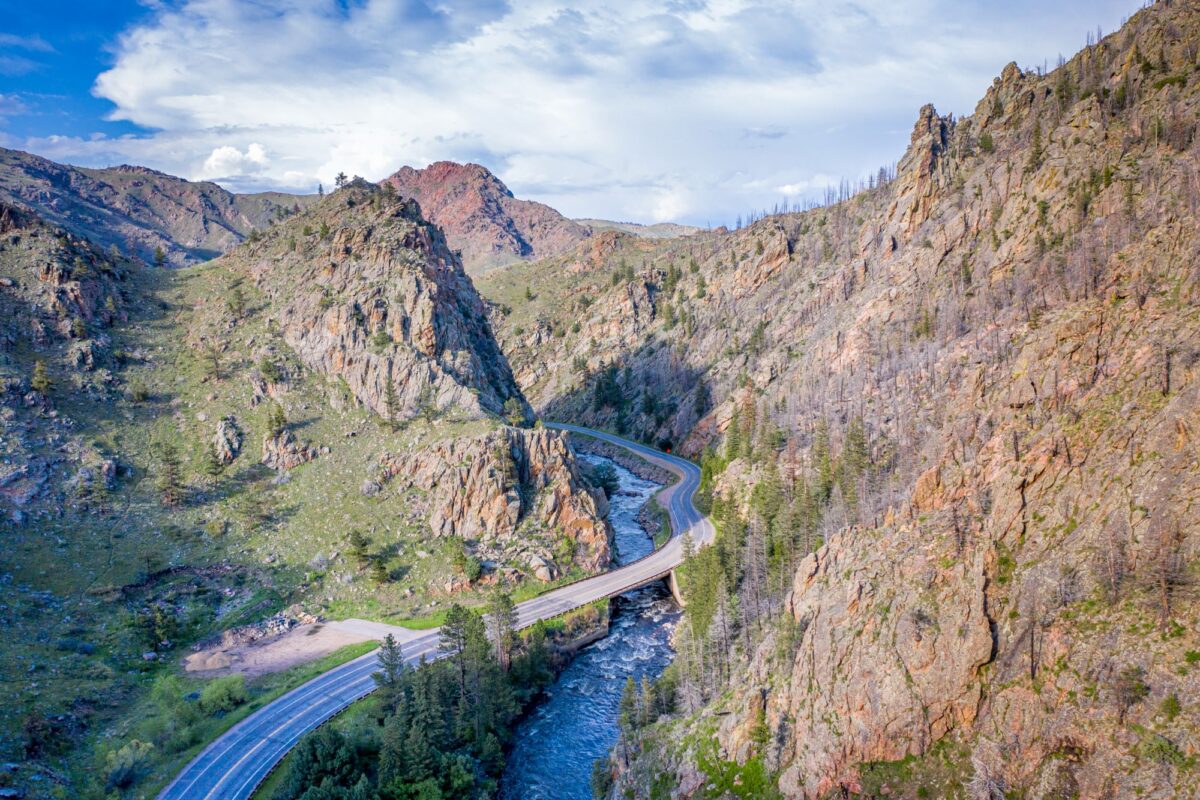
Poudre Canyon is a hidden treasure just northwest of Fort Collins in northern Colorado. According to local legend, the Cache la Poudre River got its name from French fur trappers who hid their gunpowder during a snowstorm in the 1800s. Today, the canyon offers fishing, hiking, biking, skiing, wildlife viewing and some of the best scenery around.
The Cache la Poudre is Colorado’s only federally designated Wild and Scenic River, with 76 miles protected under the designation. Colorado Highway 14 winds alongside much of the river through the canyon, providing access to picnic areas, trailheads and mountain views as the road climbs toward Cameron Pass.
You could spend days exploring the canyon, but there’s plenty to see in one trip. Here are four stops worth building into a day on the road.
Four stops worth making
- Picnic Rock — Near the mouth of the canyon, Picnic Rock is an easy place to stop and enjoy the river. There’s parking, restrooms and room to relax by the water, with canyon walls rising on either side. Be cautious near the river, especially during spring runoff, when strong currents can make entering the water dangerous.
- Greyrock Trailhead — The Greyrock Trailhead is a gateway to the hills above the canyon. From the parking area, cross the highway and follow the footbridge over the river to reach the trail. The route climbs toward higher ground and scenic views. The full hike to Greyrock is strenuous and would take up much of your day, but a short out-and-back on the lower trail can still be a worthwhile stop.
- The Mishawaka — Known locally as “the Mish,” The Mishawaka is a longtime restaurant and concert venue overlooking the river. It’s a good place to stop for lunch, enjoy the scenery and stretch your legs. Check the restaurant’s hours before your trip, particularly during the winter months.
- Cameron Pass — At 10,276 feet, Cameron Pass is one of the highlights of the drive. Surrounded by rugged mountains, including the Nokhu Crags, it offers panoramic views of the high-country landscape. Stop at the roadside parking area to take photos before heading back down the canyon.
A day trip through Poudre Canyon
This is a flexible itinerary for a full day, starting and ending in Fort Collins. Allow extra time for traffic, weather and stops along the way.
Editor's Picks
- 8 a.m. — Hit the road: Head northwest from Fort Collins on U.S. Highway 287 and turn west onto Colorado Highway 14 at Ted’s Place. Fill up on gas and pick up any food or supplies you need before heading into the canyon.
- 9-10 a.m. — Picnic Rock: Stop by the river, take photos and enjoy the scenery.
- 10-11 a.m. — Greyrock Trailhead: Take a short out-and-back walk on the lower portion of the trail. Save the full Greyrock hike for another day.
- Noon-1 p.m. — Lunch at the Mishawaka: Stop for a meal if the restaurant is open, or enjoy a packed lunch along the route.
- 1-3 p.m. — Cameron Pass: Continue west on Colorado Highway 14, allowing time for the scenic drive, a stop at the pass and photos along the way.
- 3-5 p.m. — Return to Fort Collins: Head back down the canyon, stopping at designated pullouts when conditions allow.
What to know before you go
- Limited cell service: Reception is unreliable in much of the canyon, so download maps and directions before leaving Fort Collins.
- Check road conditions: Colorado Highway 14 is a winding, two-lane mountain road. Check COtrip for current road conditions, closures and construction before heading out, especially when snow or storms are possible.
- Respect the river: The Poudre can be cold, fast-moving and unpredictable, particularly during spring runoff. Stay alert near the water’s edge and avoid entering the river when conditions are unsafe.
- Come prepared: Bring drinking water, food and extra layers. Mountain weather can change quickly, and services are limited along the route.
Road trip map
A day trip through Poudre Canyon
Four scenic stops along Colorado Highway 14, from Fort Collins to Cameron Pass.
Loading map…
1. Picnic Rock
Suggested visit: 9–10 a.m.
A riverside stop near the canyon entrance, with parking, restrooms and scenic views.
Route line follows Highway 14 using OpenStreetMap road data. Return to Fort Collins the same way. Check current road conditions before you go.
Open full round trip in Google Maps ↗Your home base for the great outdoors. Sign up for the Camp & Country newsletter
Keep the adventure going. Follow Camp & Country on Instagram, Facebook, X and Bluesky for outdoor inspiration, trip ideas and more.