
Big Bend National Park sits along the U.S.-Mexico border and spans more than 800,000 acres. It’s remote and rugged, with views of the Chisos Mountains and Santa Elena Canyon, a limestone gorge carved by the Rio Grande that many people picture when they think of the park.
I think Big Bend is one of the coolest spots in Texas, but it has drawbacks. Even after you enter the park, reaching trailheads can mean a long drive. Campsites and lodging inside the park are also in high demand. If you use Alpine or Marfa as a base, allow plenty of time for the drive into the park and on to your chosen trailhead.
These four alternatives let you experience the Chihuahuan Desert without entering the national park.
Interactive map
Explore West Texas beyond Big Bend
Big Bend National Park isn’t the only place to find adventure in West Texas. Explore four alternatives, from mountain trails and historic landmarks to rugged desert landscapes.
Locator map. Positions are approximate; not for navigation.Map: Camp & Country
Select a destination
-
Walk the grounds of a remarkably well-preserved frontier post, home to infantry and cavalry soldiers and their families from 1854 to 1891.
- Self-guided tour of the old barracks, officers’ quarters and visitor center exhibits
- Trails from flat walks to steep climbs, with bird’s-eye views of the fort
- Junior Ranger program for young visitors
- Best for
- History, scenic walks and family exploration
- Stay
- No overnight camping at the site
Plan itThe Old CCC Trail links the fort with Davis Mountains State Park, so the two pair naturally.
-
Mountain trails for every ability, a scenic drive for days when you’d rather not hike, and the option to sleep under the stars or in a hotel bed.
- About 15 miles of trails, from easy to challenging
- Skyline Drive: overlooks, photo stops and picnic spots, including a historic stone overlook
- The Old CCC Trail connects to Fort Davis National Historic Site
- Best for
- Mountain hiking, scenic drives and camping
- Stay
- Campsites in the park, plus Indian Lodge, a full-service hotel (check availability and any temporary closures)
Plan itScheduled hunts can close the park’s primitive camping area, so check alerts before you book.
-
Short, moderate hikes right above town lead to sweeping views and two of West Texas’ most delightfully odd landmarks.
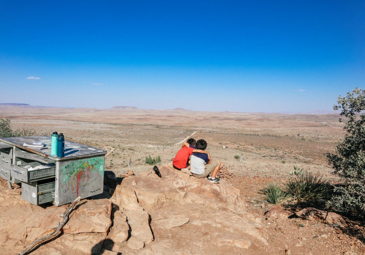
- The Desk Trail ends at a graffiti-covered metal desk overlooking the landscape; students hauled the original up in 1981
- Open the drawer to find a notebook for recording your own reflections
- The Bicycle Tree, a collaborative art piece hung with worn-out bike parts
- Best for
- Short hikes, unusual landmarks and panoramic views
- Access
- Trails cross Sul Ross State University property and some private land. Stay on suggested routes and respect posted restrictions.
Plan itThe route to the desk isn’t well marked, so review the official trail map before setting out.
-
Texas’ largest state park spreads across more than 300,000 acres of rugged Chihuahuan Desert, with far thinner crowds than its famous neighbor.
- Paved FM 170 follows the river corridor with scenic driving, picnic areas and trail access
- Much of the interior requires a high-clearance, four-wheel-drive vehicle
- Remote backcountry best suited to experienced travelers
- Best for
- Desert scenery, scenic drives, backcountry exploration and primitive camping
- Stay
- Primitive drive-up and hike-in sites. Pick up permits at Fort Leaton State Historic Site or Barton Warnock Visitor Center.
Plan itPermits and vehicle requirements vary by campsite. Confirm both before you go, and note that scheduled hunts can close the interior.
- Avoid hiking in extreme heat, even on short routes; shade is often limited.
- Cell service can be unreliable. Download offline maps and carry a paper backup.
- Check trail conditions, access restrictions and seasonal park alerts before you go.
- Make camping reservations early where required, especially for weekends and holidays.
- Confirm vehicle requirements before entering remote park areas.
Fort Davis National Historic Site
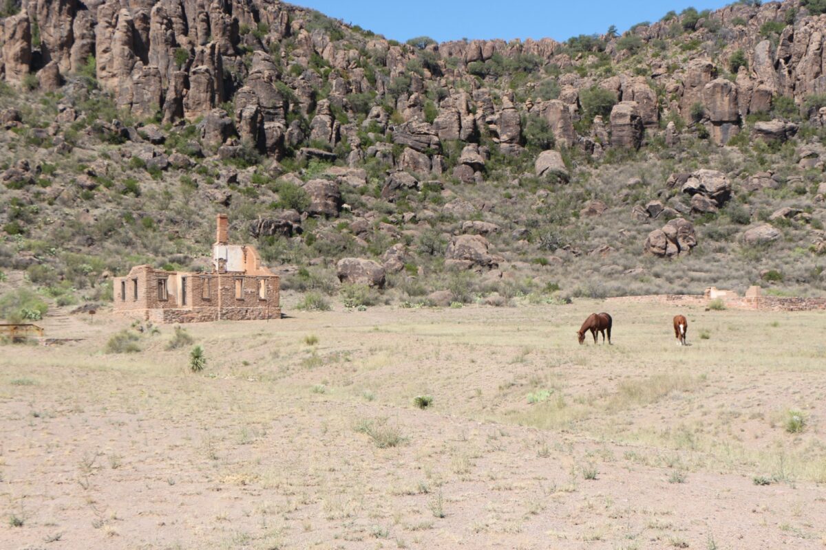
Fort Davis was a military post on the San Antonio-El Paso route. Infantry and cavalry soldiers and their families lived here between 1854 and 1891.
The fort is incredibly well preserved. You can take a self-guided tour to glimpse what life was like at this remote post in the late 1800s. The visitor center also has displays, as do the old barracks and officers’ quarters.
Hiking trails take you around the site and above it for bird’s-eye views. Options range from flat walks to steep, strenuous climbs. The National Park Service also offers a Junior Ranger program.
Overnight camping is not allowed.
Davis Mountains State Park
Davis Mountains State Park has 15 miles of trails, ranging from easy to challenging. A connecting route via the Old CCC Trail links the park with Fort Davis National Historic Site. Check the park’s trail information and map to choose your starting point and distance.
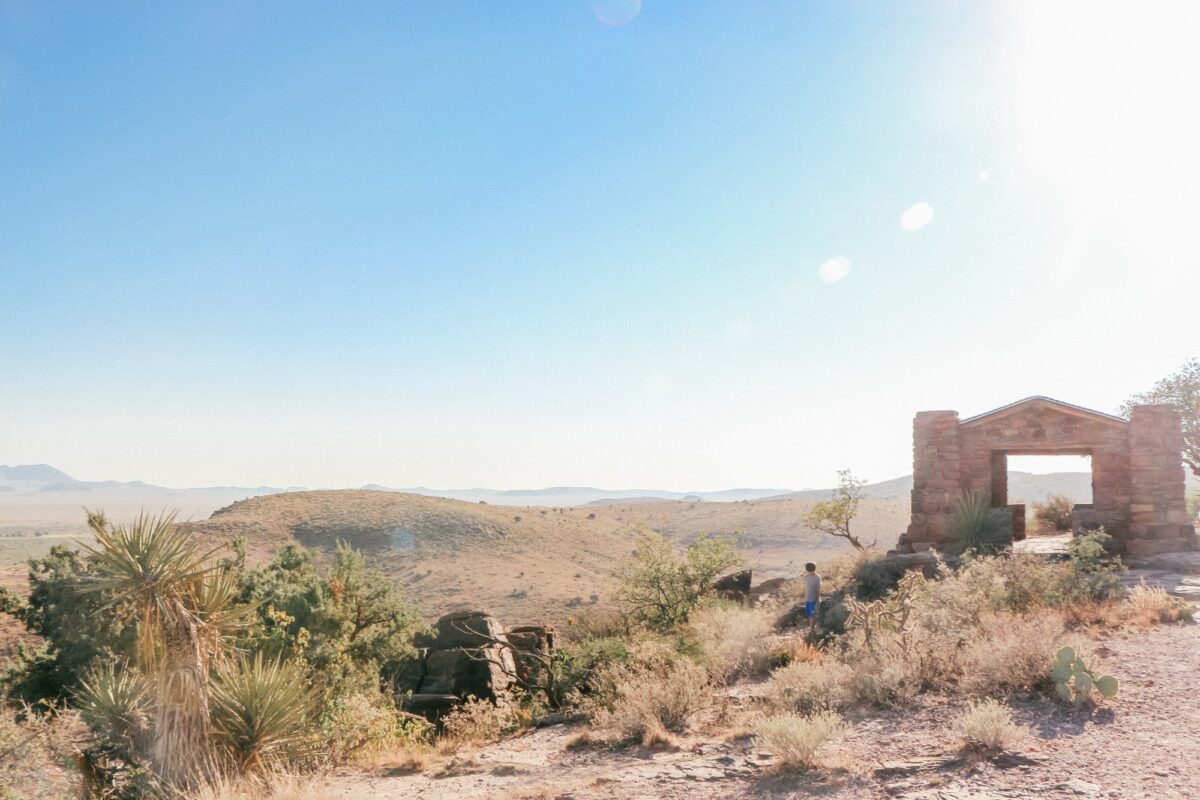
If you’re not up for hiking, you can still enjoy the scenery. Take Skyline Drive for spectacular views, photo stops and picnic spots, including the historic stone overlook.
Overnight camping is permitted. If you want something less rugged, book a stay at Indian Lodge, a full-service hotel inside the park.
Hancock Hill in Alpine
Behind Sul Ross State University is a small trail system with short, moderate hikes close to town. Some trails are on university property, while other segments pass through private land.
You can use an app like AllTrails, but I recommend checking the city’s Hancock Hill trail information and map before setting out. Follow the suggested routes and respect posted private-property restrictions.
The “Desk Trail” has a backstory: A metal office desk, covered in graffiti, overlooks a scenic vista. Open the drawer and you’ll find a notebook and pens to record your thoughts. A group of students hauled the original desk up the hill in 1981, and the university archives maintain the notebooks filled with reflections over the years.
There’s also a collaborative art installation on the hill called the “Bicycle Tree,” with worn-out bike parts dangling from the branches.
The route to the desk is moderate, but it’s not well marked, and you can veer off-trail without realizing it.
Big Bend Ranch State Park
At more than 300,000 acres, Big Bend Ranch State Park is Texas’ largest state park. If you’re looking for thinner crowds, this is the place, but be aware that its interior is quite rugged. Many interior roads require a high-clearance, four-wheel-drive vehicle. The remote backcountry is best for experienced travelers.
For a visit without tackling the interior roads, explore the river corridor along paved FM 170, with scenic driving, picnic areas and trail access.
Overnight camping is available at primitive drive-up and hike-in sites. Check vehicle requirements for your selected campsite and pick up your camping permit at Fort Leaton State Historic Site or Barton Warnock Visitor Center.
What visitors need to know
- Avoid hiking during extreme heat, even on short routes. The heat is brutal, and this area of Texas isn’t known for shade.
- Check in with rangers where available and get their input on trails, especially if you’re an inexperienced hiker.
- Expect unreliable cell service. Download maps before arriving and carry a paper backup.
- Make camping reservations early, especially for weekends and holidays. Check Texas State Parks reservation information for booking options.
- Review park alerts before traveling. Scheduled hunts can close the Davis Mountains primitive camping area and the Big Bend Ranch interior to other visitors.
Your home base for the great outdoors. Sign up for the Camp & Country newsletter
Keep the adventure going. Follow Camp & Country on Instagram, Facebook, X and Bluesky for outdoor inspiration, trip ideas and more.