
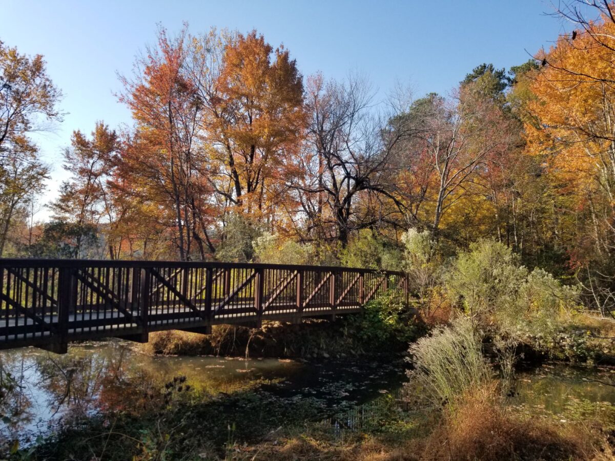
Most cyclists who live in a densely populated city face an interesting paradox. You want to ride your bike to get from point A to point B, but you must navigate cars, scooters, stoplights and crosswalks.
North Carolina has its fair share of all of these, plus plenty of pickup trucks. What sets Raleigh and its surrounding towns apart is the greenway network.
The Capital Area Greenway System consists of about 120 miles of multiuse trails for hikers, cyclists and wheelchair users across more than 3,700 acres of protected land. The network extends beyond Raleigh, too. They connect with neighboring greenway networks, allowing longer rides toward Cary, Durham and Morrisville.
Raleigh’s affectionately known as the City of Oaks, and this trail system truly allows residents easy access to nature. Some cities bring residents to the trailhead by bus. Raleigh put the trailhead in the city.
Here are three longer routes through Raleigh, plus two more regional trails worth exploring.
Camp & Country · Ride guide
Find your next Triangle bike ride
Five greenways and rail-trails, from a river-hugging epic to a ride along an old tobacco rail line. Select a numbered map marker or trail card to discover highlights and access alerts.
View trail alerts
- Closed section
- Scheduled closure
- Periodic stoppages
- Connecting greenway
- Water · parks
Ride 1 of 5 · Riverside epic
Neuse River Trail
Raleigh’s longest greenway follows the Neuse River from the foot of Falls Lake Dam all the way to the Johnston County line, trading river views for winding wetland boardwalks, historic sites and open farm fields. It’s part of the statewide Mountains-to-Sea Trail, and at its southern end it connects toward Clayton.
City of Raleigh: Neuse River Trail (opens in a new tab)Closed · no detour
Buffaloe Road Athletic Park to River Bend Park (mile markers 10–11.5)
Live updates: Raleigh greenway alerts ↗Periodic stoppages
Auburn Knightdale Road to Battle Bridge Road (mile markers 22–23.25)
Live updates: Raleigh greenway alerts ↗Status as of Nov. 18, 2026. Conditions can change quickly — check official updates before you ride.
Highlights
- Milburnie Dam and long, open views of the Neuse River
- Winding boardwalks through wetlands, interpretive signs and farm fields
- Anderson Point Park, near mile 17 — the hub where the Crabtree Creek and Walnut Creek trails join
Ride 2 of 5 · Creekside city crossing
Crabtree Creek Trail
Crabtree Creek Trail runs southeast from the edge of William B. Umstead State Park to the Neuse River Trail at Anderson Point Park, following its creek across north Raleigh. Along the way it links everyday Raleigh — Crabtree Valley Mall, North Hills — with parks and a string of connecting greenways.
City of Raleigh: Crabtree Creek Trail (opens in a new tab)Closure begins Nov. 30, 2026
Allegheny Drive to just east of Lassiter Mill Road (mile markers 9.5–11)
Live updates: Raleigh greenway alerts ↗Status as of Nov. 18, 2026. Conditions can change quickly — check official updates before you ride.
Highlights
- A western start at the edge of William B. Umstead State Park
- The Mine Creek Trail connection, leading toward Shelley Lake
- Historic Lassiter Mill, Kiwanis Park and North Hills Park (note the Lassiter Mill-area closure)
Ride 3 of 5 · Lakes to the river
Walnut Creek Trail
Walnut Creek Trail crosses southern Raleigh for more than 15 miles, linking Lake Johnson Park with the Neuse River Trail. The city pitches it as a ride through every kind of Raleigh — natural, urban and residential — and its eastern section is part of the East Coast Greenway.
City of Raleigh: Walnut Creek Trail (opens in a new tab)No closures listed
Live updates: Raleigh greenway alerts ↗Status as of Nov. 18, 2026. Conditions can change quickly — check official updates before you ride.
Highlights
- Lake Johnson’s loop trail and waterfront at the western end
- Walnut Creek Wetland Park and its trailhead
- Connections to NC State’s Centennial Campus, Lake Raleigh and the Farmers Market via the Centennial Bikeway Connector
Ride 4 of 5 · Cary’s wetland link
White Oak Creek Greenway
Cary’s signature cross-town greenway starts at the Greenway Hub in Fred G. Bond Metro Park and heads west on 10-foot-wide asphalt, along creek edges, through neighborhoods and underpasses, and across wetland boardwalks before continuing through Apex to the American Tobacco Trail. It’s part of the East Coast Greenway.
Town of Cary: White Oak Creek Greenway (opens in a new tab)Closed · reopening anticipated Jan. 2027
Green Level Church Road to I-540
Live updates: Town of Cary greenways ↗Status as of Nov. 18, 2026. Conditions can change quickly — check official updates before you ride.
Highlights
- The Greenway Hub at Bond Park, where the Black Creek Greenway links in
- A mural-lined underpass painted with native flowers, between MacArthur Drive and Davis Drive
- Wetlands and boardwalks on the western half (partly closed for repairs)
Ride 5 of 5 · Rail-trail to Durham
American Tobacco Trail
The American Tobacco Trail follows a former Norfolk Southern rail corridor that once carried tobacco toward Durham’s American Tobacco Company. Today it links southwestern Wake County, Chatham County and Durham, finishing near the American Tobacco Campus downtown. Wake County manages a 6.5-mile section; Cary and Durham manage the rest.
Wake County: American Tobacco Trail (opens in a new tab)Holiday closures
Wake County section closed Thanksgiving Day (Nov. 26)
Live updates: Wake County ATT page ↗Status as of Nov. 18, 2026. Conditions can change quickly — check official updates before you ride.
Highlights
- An old railroad corridor with deep roots in Durham’s tobacco history
- A tobacco barn built of hand-hewn logs along the Wake County section
- Woods of the Jordan Lake Game Lands, then a finish near Durham’s American Tobacco Campus
Showing American Tobacco Trail, about 22 miles one way.
About this map: Route lines are hand-drawn schematics based on official trail descriptions. They show general location and how the trails connect — they are not to scale, closure locations are approximate, and the map is not for navigation. Distances are approximate one-way figures from official trail pages.
Conditions change. Trail status is as of Nov. 18, 2026. Check before you ride: Raleigh greenway alerts · Cary greenways · Wake County: American Tobacco Trail
Neuse River Trail
The Neuse River Trail runs 27.5 miles one way along Raleigh’s eastern side, from Falls Lake Dam to the Wake-Johnston county line. Anderson Point Park lies along the route and is a great place to toss a flying disc or football around or stop for lunch.
It follows the Neuse River, offering beautiful views as it winds past open fields and farmland, away from the hustle and bustle of downtown Raleigh. At the county line, it connects with the Clayton River Walk on the Neuse, a 4-mile paved trail.
Treat yourself to an espresso with a detour to 9BAR Coffeehouse in Clayton’s Riverwood neighborhood.
Crabtree Creek Trail
The Crabtree Creek Trail runs 18 miles from the Neuse River Trail west toward William B. Umstead State Park.
For a winding, sometimes grueling change of scenery, the park has gravel multiuse trails open to mountain and gravel bikes. Check access before planning that connection: Bridge work currently blocks the route north into Umstead along Turkey Creek.
The greenway passes Crabtree Valley Mall. Take a turn onto the Mine Creek Trail for a detour toward Shelley Lake and the Sertoma Arts Center.
For a post-ride meal, consider tacos at Mala Pata on Crabtree Boulevard. Check its hours before planning your stop; it currently opens in the evening.
Walnut Creek Trail
The Walnut Creek Trail runs across southern Raleigh for more than 15 miles, from Lake Johnson to the Neuse River Trail.
Pack a lunch and spend some time at Lake Johnson Park. Bring a fishing pole for some catch-and-release from the boardwalk or fishing pier, and follow state fishing regulations.
White Oak Creek Greenway
All right, we’ve officially left Raleigh. Cary’s White Oak Creek Greenway links Bond Park with the American Tobacco Trail. It’s a great connector: At Bond Park, you can follow Black Creek Greenway toward Lake Crabtree County Park and Umstead State Park.
Check Cary’s greenway alerts before planning a through-ride. A section between Green Level Church Road and Interstate 540 is currently closed for boardwalk assessments, with no practical detour.
American Tobacco Trail
The American Tobacco Trail is the mother of all these routes. It runs about 22.6 miles one way and is relatively flat. You’ll get a range of experiences as it winds through wooded stretches in Wake and Chatham counties and into Durham.
Ride north to finish near Durham Bulls Athletic Park and the American Tobacco Campus, where options include Mellow Mushroom pizza, East of Texas barbecue and Fullsteam Brewery. You’re already on the edge of downtown, with plenty more to explore nearby.
Before you ride
Check Raleigh’s greenway alerts before choosing your route. A section of the Neuse River Trail between Buffaloe Road Athletic Park and River Bend Park is currently closed without a detour, so don’t count on riding its full length. Work near Lassiter Mill is also scheduled to close part of Crabtree Creek Trail beginning in late November 2026.
Start with a manageable out-and-back ride, wear a helmet and slow down around other trail users. Follow posted speed limits and announce yourself before passing.
Your home base for the great outdoors. Sign up for the Camp & Country newsletter
Keep the adventure going. Follow Camp & Country on Instagram, Facebook, X and Bluesky for outdoor inspiration, trip ideas and more.