
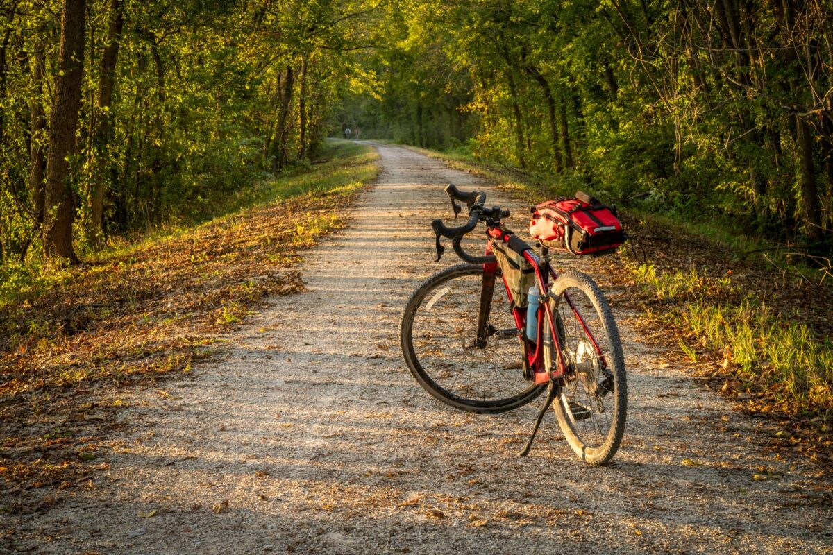
If you are reading this piece, it’s for one of two reasons: one, you’ve never heard of the Katy Trail and your curiosity is now piqued; or two, you have heard of the Katy Trail and your curiosity is now piqued. Congratulations, you’ve come to the right place.
What is the Katy Trail?
For those unfamiliar, Missouri’s Katy Trail State Park is the state’s longest and skinniest park. It is the longest developed rail-trail in the country and deserves your respect. The first section of the Katy Trail opened to the public in 1990. Today, the trail runs 240 miles through Missouri’s heartland, from the western terminus in Clinton to the eastern terminus in Machens.
First things first: The Katy is free to use and open year-round from sunrise to sunset. Its crushed-limestone route follows a former railroad corridor, making it a relatively flat ride, so you have no excuse not to ride this marvel. It is popular with touring cyclists and bikepackers in the summer. But it’s absolutely delightful in the shoulder seasons when you can expect a trailside bloom of colorful wildflowers or treelines engulfed in autumnal shades of red, yellow and orange.
Many riders tackle the Katy west to east, from Clinton to Machens, in part because prevailing winds generally come from the west. Of course, actual wind conditions can vary, so check the forecast before setting out.
Clinton to Boonville
So you decided to start in Clinton. Good choice. Double-check your gear before setting out. Make sure your clothing, foul-weather gear and camping equipment, if you’re camping, are securely attached to your bike. Check the forecast before you leave and pack accordingly. Missouri State Parks shuts off water at several trailheads from Nov. 1 through March 31, so check which services will be available along your route and plan your water stops accordingly. Plan where you’ll buy food, too, and check business hours before you leave. Make sure your bike is in good working order before you arrive in Clinton, and give it another check before you push on the pedals. Then ring the little dinner bell affixed to the trailhead kiosk and begin your journey east.
In the west, you’ll ride through cattle and corn country with a canopy of thinning leaves overhead. This portion of the trail is also known by some as the “Tour de Casey’s” as there are Casey’s General Stores scattered along the trail in the various small towns. Stop regularly to eat, drink and take a break as needed. You’ll ride through towns with names like Lewis, Calhoun, Windsor and Green Ridge. You’ll want to stop in Sedalia for a cafe lunch. Then continue through Clifton City, Beaman, Pleasant Green and Pilot Grove, riding over railroad bridges and through head-high rock outcroppings portending the limestone bluffs yet to come.
Boonville to Jefferson City
After Pilot Grove, the trail opens up and exposure to wind and weather increases but amenities are more plentiful. Boonville has the River, Rails & Trails Museum and another restored train depot, as well as the historic Katy Bridge, a former railroad lift bridge spanning the Missouri River. Built in 1932, the bridge was once threatened with demolition but was preserved after years of advocacy by supporters who wanted to save it as part of the Katy Trail. You can also stay the night at the casino or the historic Hotel Frederick in downtown. From Boonville, the landscape transforms into limestone bluffs, old-growth woodlands and long stretches of trail paralleling the Big Muddy.
In Rocheport, you’ll pass through the Katy Trail’s only railroad tunnel, a 243-foot stone-arched tunnel built around 1893. There are several places to stay, including the Katy Boxcar, a converted train car at the Katy Trail B&B. A stop at Meriwether Cafe and Bike Shop is highly recommended to rest and refuel. Fifteen miles later you’ll arrive at Cooper’s Landing, a campground and marina where you can grab refreshments and possibly catch live music overlooking the river.
Then it’s on to the picturesque little town of Hartsburg before reaching the halfway point of the trail north of Jefferson City. From the North Jefferson trailhead, you can take the Katy Spur and continue across the Missouri River into downtown Jefferson City, where you’ll find bike shops, cafes, restaurants, vacation rentals and hotels.
Jefferson City to Hermann
The second half of the trip begins with an open countryside as you ride through Tebbetts, the home of the Turner Katy Trail Shelter, a two-story bunkhouse hostel where cyclists can stay for $10 per person per day. Then Mokane, with towering grain elevators and an expansive horizon, followed by Steedman, which used to be home to two SOBs: Steedman’s Only Bar and Steedman’s Only Bank. Today, it’s a sleepy surprise with a large mysterious standing rock along the trail (it looks like the molar of a giant humanoid). Farther along the trail, Steamboat Junction Campground in Bluffton is a seasonal lodging option. At McKittrick, it’s worth taking the 2-mile Hermann Spur across the Missouri River into the German-influenced town of Hermann. Here, there are more bed and breakfasts and vacation rentals than there are residents, multiple large-scale wineries, a couple distilleries, a brewery and many places to eat. Plus, it’s very cute.
Hermann to Machens
Back on the trail, you’ll ride through Case, Gore, Bernheimer, Treloar, Peers and Marthasville before arriving in Augusta. Like Hermann, Augusta is a winery town with a brewery, many places to stay and cute cafes. Now you only have 40 more miles until you reach Machens and the end of the line. From Augusta, expect to begin to see more people on the trail and more amenities as you get closer to St. Charles near St. Louis. In St. Charles, Bike Stop Cafe is a convenient stop for food, drinks and cycling gear, with full-service bike repair available just off the trail. You can also explore First Missouri State Capitol State Historic Site, Lewis & Clark Boat House and Museum, another restored train depot and the historic downtown district, where the Corps of Discovery made final preparations before departing St. Charles on May 21, 1804. This is the final proper city on the Katy. The last 13 miles or so of the Katy Trail are flat and open without much to look at before you reach the tiny little outpost of the Machens trailhead. Here, you ring the little dinner bell affixed to the kiosk to signify the completion of your journey. Feel free to shout aloud in victory. Or cry in relief. Congratulations, you have done it. Wasn’t that fun?
Additional helpful tips
Be prepared to be prepared: Bring a spare inner tube, tire levers, a multitool, an air pump or CO2 inflator and appropriate clothing. Fall to spring weather in Missouri can range from warm sunny skies to slate gray skies with icy winds. Bring a rain jacket and additional layers for warmth as needed.
Plan ahead: Research the towns where you plan to stop and check available trail services before you leave. Business hours and services can vary, particularly in the cooler months. Be proactive about eating and drinking throughout the ride and carry extra food and water when services are limited. Beer optional.
Explore the Katy Trail
The Katy Trail runs about 240 miles across Missouri, from Clinton in the west to Machens in the east. It is open year-round from sunrise to sunset. The interactive map needs JavaScript; if you can read this, it did not load.
- Section 1, Clinton to Boonville: farmland, Sedalia and railroad history.
- Section 2, Boonville to Jefferson City: river bluffs and the Rocheport tunnel. Jefferson City is a spur from North Jefferson.
- Section 3, Jefferson City to Hermann: river-bottom towns. The Hermann Spur leaves the main trail at McKittrick.
- Section 4, Hermann to Machens: Augusta, St. Charles and the final open stretch.
From Nov. 1, 2026, through March 31, 2027, water is turned off and restrooms close at several trailheads. This is a published advisory, not a live feed.
Official seasonal advisory · Check current trail conditions · Katy Trail State Park
Your home base for the great outdoors. Sign up for the Camp & Country newsletter