
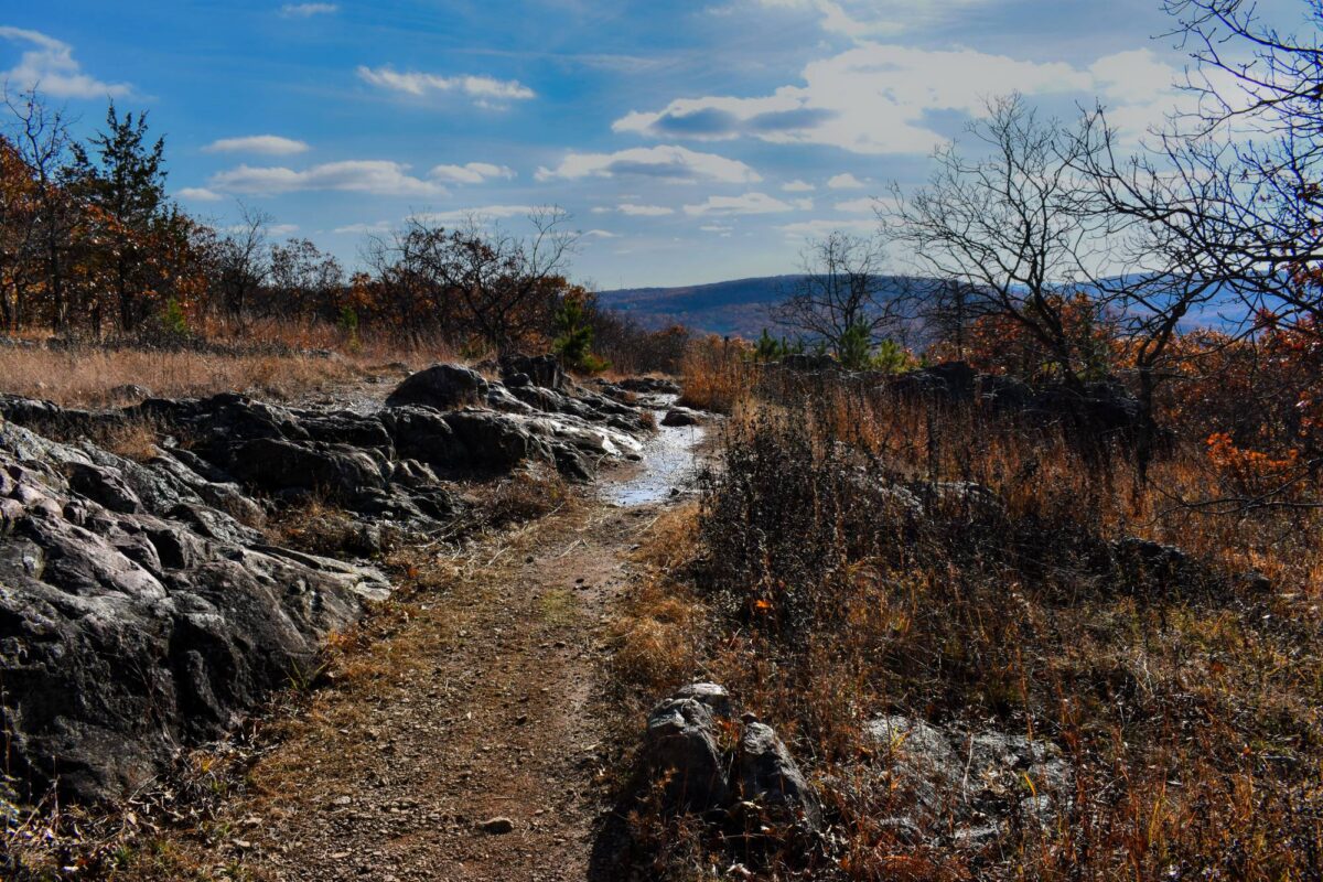
One of the best ways to enjoy Missouri’s natural beauty is on foot, taking in the sights, sounds and smells of its forests, glades, meadows and prairies. And with so many trails to choose from, where does one start?
Fortunately, hiking doesn’t have to end when the weather turns cold. These five trails offer everything from a relatively short and easy saunter to more strenuous full-day efforts. With shorter days and colder temperatures, be sure to check trail conditions before heading out, particularly on routes with stream crossings or seasonal closures.
Berryman Trail, Mark Twain National Forest — 24-mile loop
The Berryman Trail forms a roughly 24-mile loop through Mark Twain National Forest in Missouri’s Ozarks, near Steelville and Potosi. Popular with hikers, mountain bikers and horseback riders, the trail winds through oak and pine forests, open fields, rocky ridges and quiet creek bottoms.
You’ll encounter plenty of twists, turns and switchbacks as the trail moves between higher ground and lower valleys. It’s a fairly hilly route, so don’t expect an easy walk. The western portion also follows the Courtois section of the Ozark Trail, making it part of a larger network of hiking opportunities.
Several stream crossings lack bridges, so be prepared for potentially wet feet, especially in colder weather.
Rocky Top Trail, Lake of the Ozarks State Park — 2-mile loop
The Rocky Top Trail at Lake of the Ozarks State Park near Osage Beach is well worth exploring. This moderately rugged two-mile route takes you over the hills and through the hollows of the Ozarks before winding to an open blufftop view of the lake below.
You’ll start by walking through a dolomite glade that seems more like a lunarscape in late fall and winter before descending into a ravine and climbing through a white oak forest.
The trail is actually two loops joined together. About a half-mile in, you’ll reach an intersection where you can follow the lakeshore back to the trailhead for a hike of roughly one mile. For the full route, continue across the small ravine and climb toward the lake overlook.
Smith Creek Loop, Mark Twain National Forest — 5-mile loop
The Smith Creek Loop is part of the 36-mile Cedar Creek Trail System in Mark Twain National Forest, just outside Fulton. The trail takes you through stretches of forest, along rocky sections and past Smith Creek.
The five-mile loop is marked with orange diamonds and offers impressive views of Cedar Creek from the bluffs above. A section of the trail crosses Smith Creek without a bridge, so be prepared for a potentially wet crossing, especially in colder weather.
If you’re looking for a longer hike, Smith Creek connects with the 22-mile Southern Loop, which also links to the 6.2-mile Moon Loop and 2.8-mile Pine Ridge section. Otherwise, stick with Smith Creek for a mix of terrain and plenty of quiet stretches where you can take a break and enjoy the surroundings.
Thousand Hills Trail, Thousand Hills State Park — 16-mile loop
Thousand Hills Trail in Thousand Hills State Park near Kirksville is the only hike on this list outside Missouri’s Ozark region. But it still shares similarities with its rugged Ozarkian brethren.
The trail winds through hilly, wooded terrain, with stretches along Forest Lake and sections that pass through restored savanna areas. It’s a rugged route with plenty of ups and downs, rocks and roots.
In April 2026, a new 5.5-mile extension turned the trail into a 16-mile loop around the lake, giving hikers even more ground to cover.
White River Valley Trail System, Table Rock State Park — 11.3 miles
The White River Valley Trail System at Table Rock State Park near Branson features four interconnected loops, each offering a different experience. White connector trails allow you to shorten or lengthen your hike.
The Red Loop is the most technically challenging, with an elevation change of about 120 feet. The Blue Loop offers some of the most diverse natural scenery, with nearly 400 feet of elevation gain on the climb to Baird Hill. The Orange Loop is the shortest, with an elevation difference of about 110 feet, while the Green Loop reaches the highest point in the trail system at nearly 1,200 feet and offers great views.
Regardless of which loop you choose, expect rocky sections, steep climbs and plenty of elevation changes. Along the way, you’ll pass through wooded areas, come across small waterfalls and find views of Table Rock Lake and Lake Taneycomo. There’s even an old abandoned farmstead along the route.
Just keep in mind that this is more of a workout than a casual stroll. The entire trail system closes following rain, and portions on U.S. Army Corps of Engineers land close during firearms deer and turkey hunting seasons. Check current conditions before heading out.
Bonus: The Ozark Trail — more than 430 miles of trails
If you’re feeling particularly adventurous or ambitious, you could tackle a longer stretch of the Ozark Trail. Missouri’s best-known long-distance hiking trail system covers more than 430 miles through the rugged hills and forests of the Ozarks. Not all of those miles are connected, but the established thru-hike route covers approximately 230 miles.
Along the way, you’ll find rocky bluffs, quiet hollows, clear-running streams, natural springs and plenty of wooded stretches. Some sections are relatively easy day hikes, while others offer steep climbs and rough terrain better suited for experienced hikers and backpackers.
Just be sure to check the individual section before heading out, since distances, difficulty and trail conditions can vary quite a bit.
Find your next Missouri hike
From lakeside overlooks to rugged Ozark forests, explore five Missouri trails worth hiking in late fall and winter. Select a hike to see its location, distance and seasonal considerations.
-
Berryman Trail, Mark Twain National Forest
Approximately 24-mile loop
A challenging Ozark loop through oak and pine forests, rocky ridges, open fields and creek bottoms.
Access: Near Steelville and Potosi. The main trailhead is at Berryman Campground, about 16 miles west of Potosi off Highway 8 via Forest Road 2266.
Winter note: Several stream crossings have no bridges. Cold-weather hikers should be prepared for wet crossings.
Trail information (U.S. Forest Service) (opens in a new tab)Directions to trailhead (Google Maps, opens in a new tab)
-
Rocky Top Trail, Lake of the Ozarks State Park
2-mile loop, with a shorter option of about 1 mile
A moderately rugged hike through dolomite glades, wooded ravines and bluffs overlooking Lake of the Ozarks.
Access: Near Osage Beach, in the park’s Grand Glaize Beach area.
Winter note: Rocky terrain and exposed glades call for sturdy footwear and attention to conditions.
Trail details (Missouri State Parks) (opens in a new tab)Directions to trailhead (Google Maps, opens in a new tab)
-
Smith Creek Loop, Mark Twain National Forest
5-mile loop
A forested loop in the Cedar Creek Trail System with rocky sections, creekside scenery and bluff views overlooking Cedar Creek.
Access: Near Fulton. Smith Creek Trailhead is off County Road 354 north of Millersburg; parking is limited to a few vehicles.
Winter note: The Smith Creek crossing has no bridge, which may mean wet feet. That’s particularly challenging in colder weather.
Trail information (U.S. Forest Service) (opens in a new tab)Directions to trailhead (Google Maps, opens in a new tab)
-
Thousand Hills Trail, Thousand Hills State Park
16-mile loop
A rugged hike through rolling wooded hills, restored savanna and sections along Forest Lake. A 2026 extension created a complete loop around the lake.
Access: Near Kirksville. The main trailhead is the first parking lot on the right after the park office, along Big Loop Trail Road.
Winter note: Expect substantial distance, elevation changes, rocks and roots. Plan for shorter daylight hours.
Trail extension details (Missouri DNR) (opens in a new tab)Directions to trailhead (Google Maps, opens in a new tab)
-
White River Valley Trail System, Table Rock State Park
11.3 miles of interconnected trails
Four connected loops with rocky climbs, wooded valleys, small waterfalls and views of Table Rock Lake and Lake Taneycomo.
Access: Near Branson. Trailhead 1 is on Highway 165, north of the park’s main entrance.
Winter note: The entire system closes following rain. Portions on U.S. Army Corps of Engineers land also close during hunting seasons, including firearms deer and turkey seasons.
Trail details (Missouri State Parks) (opens in a new tab)Directions to trailhead (Google Maps, opens in a new tab)
Location overview only. Check official trail maps, closures and current conditions before heading out.
Your home base for the great outdoors. Sign up for the Camp & Country newsletter
Keep the adventure going. Follow Camp & Country on Instagram, Facebook, X and Bluesky for outdoor inspiration, trip ideas and more.